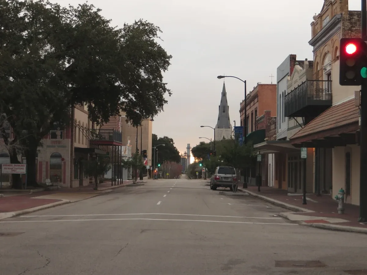
Three Major Highways Meet
Strategic Location Near the Gulf Coast
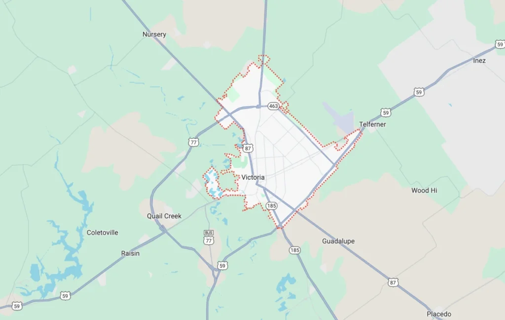
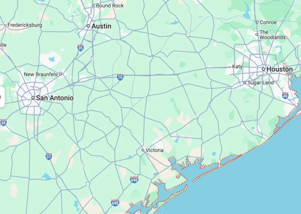
The Gulf of Mexico is just 30 miles away, making Victoria a gateway for regional commerce and transportation. Major Texas cities are within easy reach – Houston (120 miles), San Antonio (102 miles), Austin (110 miles), and Corpus Christi (75 miles). This spot makes Victoria perfect for distribution and logistics operations.
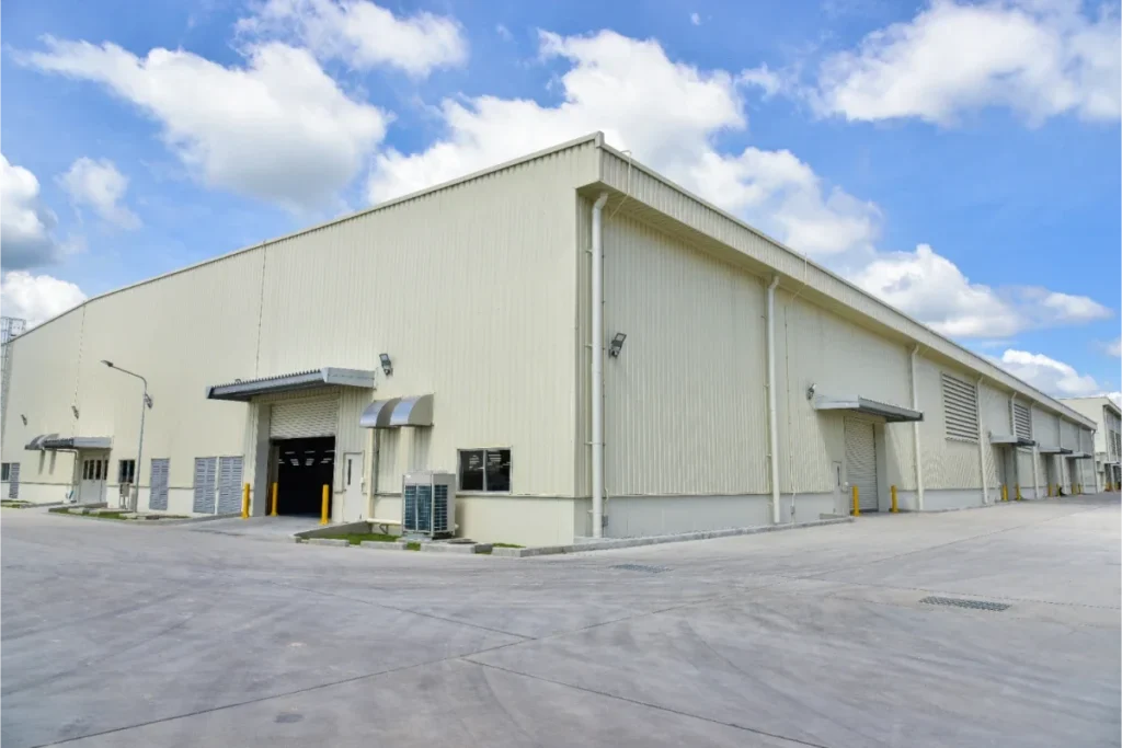
The Port of Victoria adds to these advantages with its harbor 35 miles from the Gulf Coast. The North Industrial Park offers canal sites from 10 to 2,000 acres which includes water, rail, and four-lane divided highway access. The South Industrial Park houses the Texas Logistics Center, which provides custom infrastructure options for businesses that need specific transportation solutions.What Makes a Geographic Crossroads
The city serves as more than just a highway hub. Businesses benefit from complete freight carrier services, a regional airport, railway terminals, and both shallow and deep-water ports. The Texas Logistics Center shows off these multi-modal capabilities with its dual-rail access and nearby interstate highways. Businesses here enjoy tax benefits and financial incentives thanks to its location in a Foreign Trade Zone and Texas Enterprise Zone.
Victoria Texas plays a key role in the international I-69 corridor project that will link U.S. cities with Canada and Mexico. This prime location draws businesses from many industries, making Victoria the commercial center for nearby counties. The city keeps growing as a crossroads, helping businesses connect through better connections to major markets in Texas and beyond.
U.S. Highways 59, 77, and 87 Transform the Region
Highway 59: The NAFTA Superhighway
U.S. Highway 59, known as the Lloyd Bentsen Highway, runs 615 miles from Laredo to Texarkana. This vital part of the NAFTA Corridor Highway System connects Mexico to the United States through the World Trade International Bridge. The highway’s importance continues to grow, with 90 percent of it becoming part of Interstate 69.
Drivers can cruise at 75 miles per hour in certain stretches, making trips between major Texas cities quick and easy. The highway cuts through Victoria as a divided road with several interchanges, which makes travel safer and smoother for trucks and cars alike.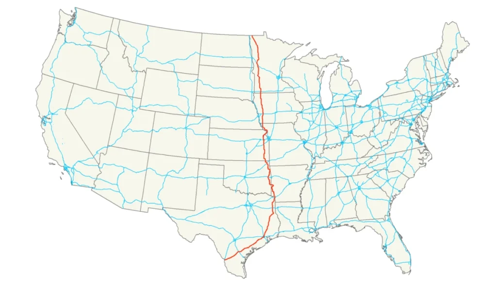
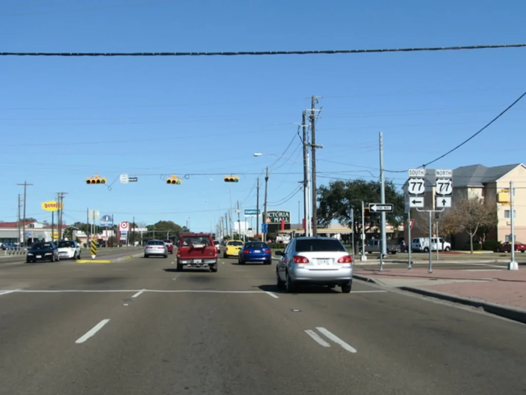
U.S. Highway 77 serves as a lifeline between the Rio Grande Valley and northern Texas. A massive $364 million project aims to bring this road up to interstate standards. The upgrades will add overpasses and frontage roads roughly every five miles. This design helps emergency vehicles respond faster and gives ranches better access to the highway.
The project splits into two parts. $191 million goes toward building main lanes and overpasses north of Norias Road, while $173 million funds similar work in nearby areas. The Rio Grande Valley will get its first direct interstate connection to the national highway system once work wraps up.U.S. Highway 87’s story begins with the Beach Road, which helped develop Jefferson County in its early days. The road starts near the Gulf Coast in Port Lavaca and heads north through San Antonio, Lubbock, and Amarillo. It became part of Texas’s ‘Hug-the-Coast’ highway system back in 1940.
The highway did more than move traffic. During World War II, it helped protect the coast with U.S. Immigration Service checkpoints and Coast Guard patrols. Hurricanes and erosion have damaged some coastal sections, but inland parts still keep regional commerce moving strong.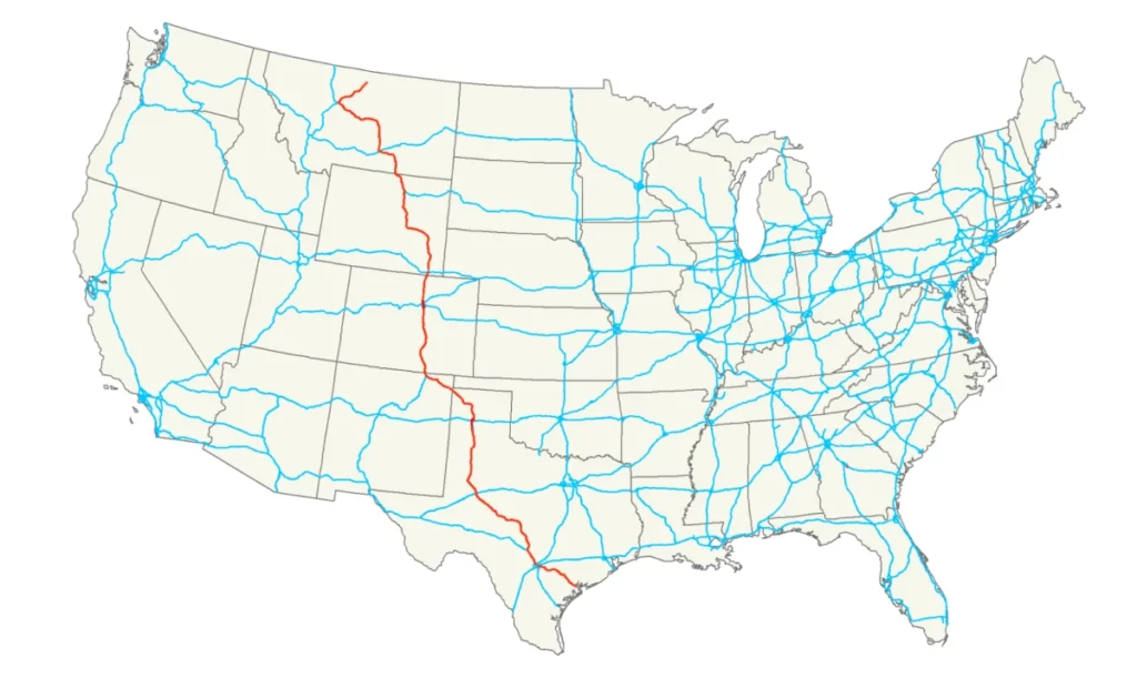
Distribution and Logistics Hub
Energy Sector Development

Retail and Service Industries at The Crossroads
Victoria’s strategic transportation network creates perfect conditions for retail and service sector growth. Studies show that highway-oriented commercial development helps business communities succeed. A recent census in one metropolitan area showed that all but one of these business firms outside the central city belonged to the highway-oriented category.
Transportation networks bring more than just immediate economic benefits. The Texas Department of Transportation estimates that maintaining various transportation modes “in a good state of repair” needs USD 547 billion in state and federal funding through 2040. This investment shows how vital transportation infrastructure is to economic growth in the Crossroads region.Navigating Through Victoria County's Transportation System
Major Intersections and Traffic Patterns
The Victoria Metropolitan Planning Organization and Texas Department of Transportation collect sophisticated traffic data. Their 24-hour bi-directional counts track vehicles moving in both directions during a single day. TxDOT manages over 75,000 short-term traffic counts each year across the state and maintains 350 continuous monitoring stations that collect data year-round.
Frontage roads along U.S. Highway 59 between State Highway 185 and U.S. Highway 87 have switched to one-way traffic. This change lets contractors rebuild entrance & exit ramps, which improves traffic flow at major intersections.Public Transportation Options
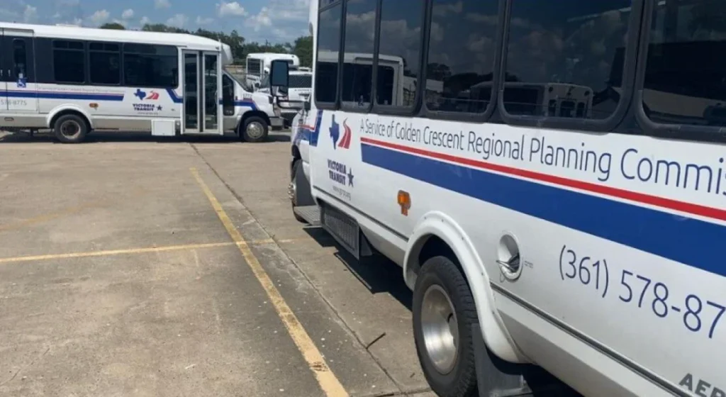
Victoria Transit runs a fixed-route system that serves the community through color-coded routes. The system will keep seven routes running until September 2024: Gold, Teal, Pink, Brown, Red, Green, and Blue. Budget constraints will reduce service to three routes – Red, Green, and Blue – running from 8:00 AM to 12:00 PM and 1:00 PM to 5:00 PM.
Victoria County Transit, five years old, provides safe and affordable transportation for county residents.
- Four fixed routes with over 160 scheduled bus stops
- Wheelchair-accessible vehicles for persons with disabilities
- Weekend service on three routes covering 80 bus stops
- Transfer stations marked by circled-star symbols
Move Victoria 2050 Metropolitan Transportation Plan maps out long-term transportation improvements for the next 25 years. Community feedback from 2024 addressed concerns about congestion, traffic signals, and pedestrian safety.
A major expansion project on U.S. 77 between U.S. 87 and FM 1685 will reduce bottlenecks by adding two lanes in each direction.- Construction of a second bridge over the Guadalupe River
- Addition of six bridges over flood-prone areas
- Implementation of inside shoulders on existing lanes
- Widening of outside shoulders
Beyond the Roads: Victoria's Strategic Advantages
Access to Gulf of Mexico Ports
The Port of Victoria is a vital gateway to domestic and international markets, just 35 miles from the Gulf Coast. The port features:
- A shallow-draft commercial port with two docks
- A turning basin with 12-foot channel depth
- Over 2,000 acres of available land
Victoria Regional Airport Improves Connectivity
Victoria Regional Airport, once Foster Air Force Base, serves as a vital transportation link 5 miles northeast of downtown Victoria.
- 1,766 acres of land
- Two runways and a helipad
- General aviation services at The Jet Center
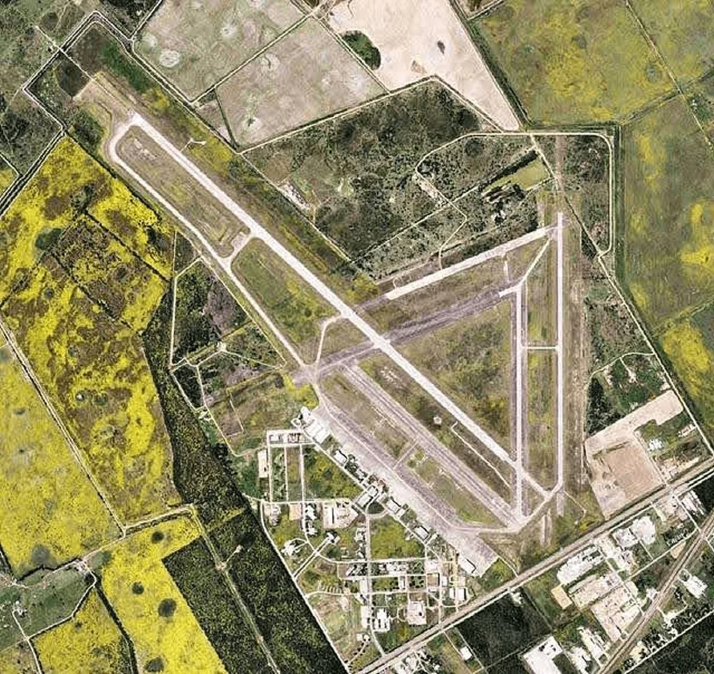
United Express, operated by SkyWest Airlines, runs two daily flights to George Bush Intercontinental Airport in Houston. The airport handled 57,422 aircraft operations in 2019, averaging 157 daily. Military operations made up 80% of traffic, while general aviation accounted for 13% and air taxi services 6%.
A 55-minute flight to Houston strengthens Victoria’s role as a transportation center. Travelers can easily access international destinations through one of America’s busiest air hubs. This air service adds to the city’s extensive ground transportation network and confirms its position as the Crossroads of South Texas.Visit The Crossroads Area of South Texas
Victoria’s location and strong transportation infrastructure showcase its strategic value. Major highways U.S. 59, 77, and 87 meet here to reshape this South Texas city into a key transportation hub that connects major cities and helps the regional economy grow. The city sits just 30 miles from the Gulf Coast, which gives businesses and travelers advantages.
The transportation network goes beyond just highways. Victoria Regional Airport, the Port of Victoria, and rail links work together to create a hub that serves a variety of industrial needs. These transportation assets draw attention from investors, especially in the logistics, energy, and retail sectors.
Fifteen million Texas consumers live within a half-day’s drive of the city. Businesses here also benefit from tax advantages through Foreign Trade Zone status. Victoria’s infrastructure keeps getting better, and planned improvements will strengthen its role as South Texas’s main crossroads.
Victoria’s status as the Crossroads of South Texas means more than just crossing highways. It’s where commerce, transportation, and new chances meet to create a hub for regional growth and development.